Follow along with outdoorsman and writer Johnny Molloy as he treks through the mountains of Northeast Tennessee.
The Appalachian Trail snakes its way more than 280 miles through Northeast Tennessee, Southwest Virginia and western North Carolina. Walk through the open meadows, mountain balds, watery valleys, and view rhododendron blooms unlike anywhere else on the planet. There’s no shortage of trail hikes, and we’ve put together a few of our favorite AT access points.
Elk Garden, VA
36.646216, -81.582413
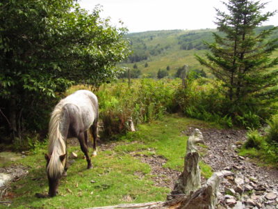
This 8.8 mile to and back section of the Appalachian Trail offers a series of views from the moment it leaves Elk Garden, passing through a rare and lofty spruce-fir forest, late summer blueberries, and wild pony grazing areas. To reach Mount Rogers, Virginia’s highest point, the hike leaves the AT on the Mount Rogers Spur Trail reaching 5,729 feet.
Damascus, VA
36.635367, -81.792014
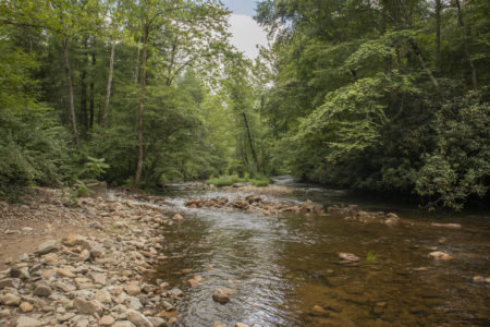
This begins in a trail town with personality, Damascus. Leave the Damascus Town Park on the AT/Virginia Creeper Trail through wooded ridges to reach a rewarding view of adjacent mountains for a 6.0 mile to and back hike.
Cross Mountain, TN
36.481325, -81.960443
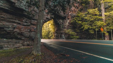
The first half-mile of this hike is for everybody, with a universal access pathway over a view-laden meadow. The highlights come early as you trace the AT across open fields of the old Osborne Farm with far-reaching panoramas into Shady Valley, Tenn. From there, you can make your way to Double Spring Shelter, an AT shelter on Holston Mountain, then backtrack for a total 5.8 mile to and back hike.
Watauga Dam, TN
36.329064, -82.111755

Leave Iron Mountain Gap near Watauga Dam on the spine of Iron Mountain, using the AT to reach Laurel Branch Wilderness. The 9.2 mile to and back trail eventually leads to Vandeventer shelter, presenting panoramas of Watauga Lake and a host of mountains.
Hampton, TN
36.285433, -82.152153
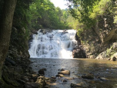
This 4.8 mile to and back hike takes you to Laurel Falls following an old railroad bed along the AT into the heart of the Laurel Fork Gorge on the Blueline Trail. Pass a sheer rock bluff, the first of many geological features, before meeting the Appalachian Trail. Laurel Falls drops 60 feet into a deep churning pool, and is popular with summertime swimmers.
Carvers Gap, TN-NC
36.106520, -82.110349

Straddling the Tennessee-North Carolina state line, this 4.8 mile to and back hike leads to two grassy balds, with views above 6,000 feet. This walk can easily be shortened for children and beginner hikers.
Spivey Gap, NC
36.032323, -82.420386
Join the AT by Spivey Gap, near the Tennessee-North Carolina state line. This 3.4 mile to and back hike takes you over Big Creek and the stone outcrop of High Rocks, where an open slab avails extensive views of the surrounding mountains.
Camp Creek Bald, TN
36.024762, -82.715139
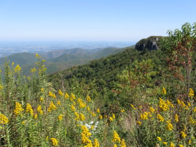
Hike the AT to Big Firescald Ridge and its challenging rock gardens for stellar vistas of both Tennessee and North Carolina. Return to Camp Creek Bald via the AT “Bad Weather Route” for a 4.4 mile to and back hike.
Hot Springs, NC
35.893269, -82.822272
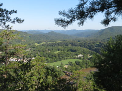
Hike from this quiet and quaint trail town on the French Broad River for a 3.9 mile loop with mountain views along the Pump Gap Trail.
Guided Trips
For guided day and overnight backpacking trips, we recommend White Blaze Outdoors.
Backpacking Tips
Avoid nice weather weekends and holidays if you are seeking solitude. Our trails can be very busy with both day hikers and backpackers.
Leave No Trace
Remember to leave our trails with no trace, so adventures can last a lifetime. Find out how you can make a difference with our leaders for litter-free Tennessee efforts.

Johnny Molloy is the author of many outdoor guides including Best Tent Camping: Tennessee, Paddling Tennessee, and Five Star Trails Tri-Cities: East Tennessee and Southwest Virginia.


