Follow along with outdoorsman and writer Johnny Molloy as he treks through the mountains of Northeast Tennessee.
The Appalachian Trail travels between Tennessee and North Carolina along the crest of the Southern Appalachian Mountains. Below them, run lesser- used trails with wild waterfalls, ridge lined views, and solitude galore.
Winter can be a great time for cascades rimmed in ice without the crowds. Below is a list of waterfalls you can savor when the temperature drops:
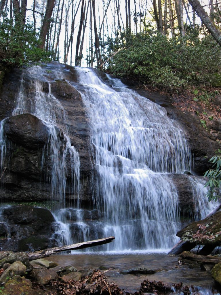
Petes Branch Falls
Trailhead Coordinates: 36.104882, -82.653508
Make the 3.8-mile round-trip from Horse Creek Recreation Area near Greeneville to a four-wheel drive accessible road in Horse Creek, part of the greater Bald Mountains trail system. Trek up Horse Creek Valley, hopping the stream a few times before joining Poplar Cove Trail to pick up Petes Branch Trail, passing an abandoned homestead. At higher flows, you’ll see two distinct waterfall ribbons making Petes Branch Falls.
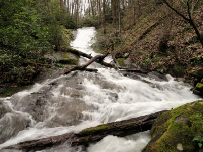
Mary Falls
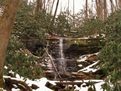
Trailhead Coordinates: 36.064600, -82.680750
This challenging 3.6 mile round-trip begins at Round Knob Picnic Shelter on a lesser maintained trail near Greeneville. Follow Davis Creek Trail, passing a forgotten homesite before crossing Davis Creek. You’ll criss-cross the stream numerous times, as well as head directly up the creekbed. The hollow is sometimes as narrow as a shoelace. When approaching Marys Falls, you will be on the left hand bank of the stream heading uphill on a clear section of graded trail. The lack of a beaten down trail leading to the base of 35-foot waterfall testifies to the infrequent visitation.
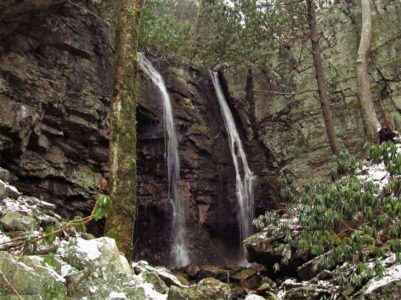
Hickey Fork Falls
Trailhead Coordinates: 36.005791, -82.694488
The 2.6-mile round-trip hike starts off just past the Tennessee state line in North Carolina. You’ll begin in fun fashion crossing East Prong Hickey Fork on a log bridge. Head up the narrow valley with the sound of West Prong Hickey Fork in the background. The first sizeable faucet-style Hickey Fork Cascades drops over 100 feet flanked by rhododendron and shaded by hardwoods. Continue to the main attraction, Hickey Fork Falls. This spiller is more of a classic curtain-type cataract, sloping over a rock ledge, then diving down a tiered 35-foot high stratified ledge.
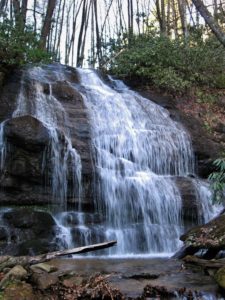
Whiteoak Branch Cascades
Trailhead Coordinates: 36.023361, -82.652500
The 1.8 mile round-trip to this 100-foot spiller is rarely visited. Take the Jerry Miller trailhead just past the Tennessee state line in North Carolina, cruising over a hill where white trilliums bloom by the thousands in spring. At the .9 mile marker, as Whiteoak Flats Branch and the trail finally come together, you’ll see the 100 foot Whiteoak Flats Cascade. Despite its length and opulence, no beaten trail to it exists, but the cataract isn’t difficult to photograph if you are willing to work for it.
Leave No Trace
Remember to leave our trails with no trace, so adventures can last a lifetime. Find out how you can make a difference with our leaders for litter-free Tennessee efforts.

Johnny Molloy is the author of many outdoor guides including Best Tent Camping: Tennessee, Paddling Tennessee, and Five Star Trails Tri-Cities: East Tennessee and Southwest Virginia..