Follow along with outdoorsman and writer Johnny Molloy as he treks through the mountains of Northeast Tennessee.
Camp Creek Bald, near Greeneville, is a great place to escape summer’s heat, view fall colors from the crest of the Southern Appalachians, or take a hike anytime of the year. The Appalachian Trail (AT) travels through the area of meadows, heath balds, and rock outcrops.
Alternately known as Jones Meadow, Camp Creek was once the site of a proposed housing development in the early 1980s. The development was called Viking Mountain, but it went bust, as the US Forest Service secured and now maintains the land. Just up the mountain you will see antennas perched atop the peak of Camp Creek Bald, at 4,844 feet elevation.
This part of the Cherokee National Forest is known as the Bald Mountains Scenic Area, and is deserving of the moniker. Running adjacent to the Shelton Laurel Backcountry in North Carolina’s Pisgah National Forest, this mountainous part of Northeast Tennessee delivers beauty and ruggedness high and low.
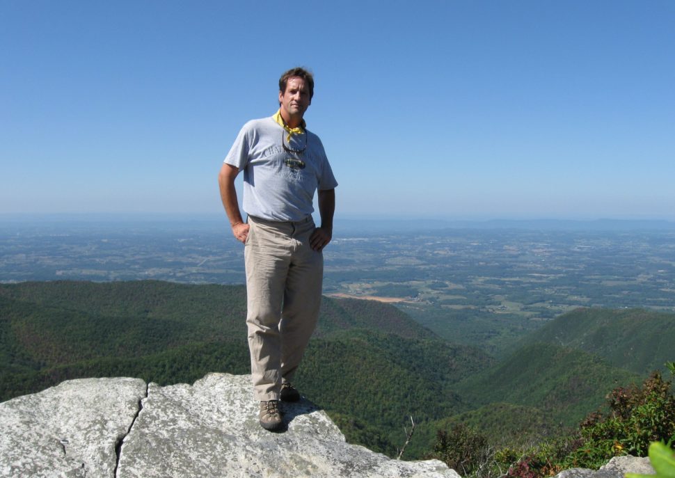
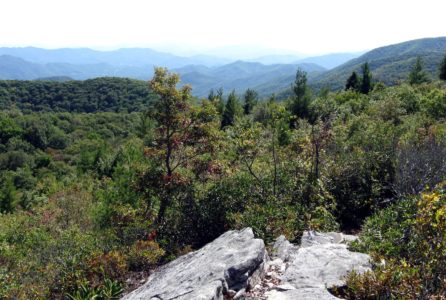
I drove to Camp Creek Bald on one of those dry, clear days that allow views extending for untold distances. My buddies John and Steve would meet up with me later that evening, as I set off down the Appalachian Trail, backpack strapped on tight. Summertime flowers were blooming and it was a great day to be alive and in the Southern Appalachians. The AT passed by the Blackstack Cliffs, an easy trek (less than a ½ mile from the trailhead) with superlative views (and where I proposed to my wife). I then hiked atop the open stones of Firescald Ridge on what is called the “Exposed Ridge Route.” In places, the rocks rise as a gray spine, offering continuous views above steep drop offs. Waves of mountains extended to the eastern horizon, including Big Bald near Unicoi, Tenn., as well as into North Carolina. While to the west, the mountains yielded to the patchwork of agricultural lands of Greene County and beyond.
After four miles I made Jerry Cabin trail shelter. The shelter is one of the wood or stone huts situated at periodic intervals along the entire 2,000 plus mile Appalachian Trail. They are primitive, and usually open on the front. Cooler air came with dusk, so I made a warming fire and waited for my comrades to show up. Unfortunately, they didn’t arrive until late – Steve at 1 a.m. (after hiking in the dark) and John (always late) the next morning!
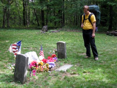
The morning low was in the mid-50s, as the three of us left the shelter and headed north, cruising over Coldspring Bald, another view-laden mountain meadow. We stopped at the Shelton Laurel Graves, internment of slain Civil War soldiers. Northeast Tennessee was a mixed bag of loyalties, so skirmishes broke out among conscripted soldiers and the general populace. Here, Union soldiers David and William Shelton and another unidentified man, all from the North Carolina side of the mountains, were returning to meet their families atop Coldspring Mountain, but were killed by Confederate loyalists. They are buried on the crest in a single grave. Later, the US government provided markers for them. Their trailside graves surprise many a passer-by.
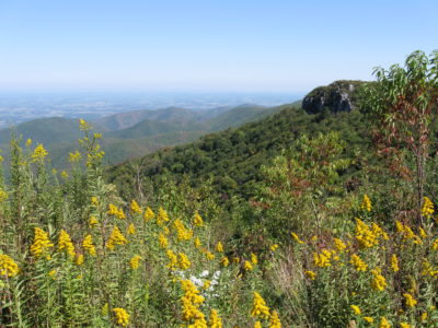
More views awaited atop Big Butt, where a stone protrusion rimmed in mountain ash trees allows for far reaching looks in all directions. Stopping for all the highlights kept us from getting a head of steam, yet this adventure was about the journey and not the endpoint.
We came upon Ball Ground next, this highland field was purportedly where Cherokee Indians played a game resembling stickball. The Indians would choose sides, usually 10-15 men on a team. A pole up to 40 feet high was stuck in the middle of the field, with a skull of some type atop the pole. The goal was to hit the skull with a small leather ball, around two inches in diameter, using a stick with a cupped end, resembling a giant spoon. The players could not use their hands. Several areas in the Southern Appalachians have names indicating their use for Cherokee games.
Ahead, we made camp in a gap. A downhill trickling spring kept us in water. Unbeknownst to us, the three of us were about to get more water than we ever wanted. A big rain hit overnight but we stayed dry in our shelters. Next morning, we hurriedly broke camp, and I got a fire going for coffee and toasted bagels. It was a wet walk back along the Tennessee/North Carolina state line. Once back at Camp Creek Bald, the cloudy skies cleared and we soaked in one last superior panorama of Northeast Tennessee before jumping into our vehicles and heading home.
Leave No Trace
Remember to leave our trails with no trace, so adventures can last a lifetime.
How to Get There:
To reach Camp Creek Bald from the intersection of US 321 and TN 107 in Greeneville, take Asheville Highway/TN 107W/TN 70S for 14.8 miles to turn left on Viking Mountain Road (If you reach North Carolina and Allen Gap you’ve gone too far). Follow Viking Mountain Road for 7.9 miles to reach Camp Creek Bald. Here, the road splits – head left for .3 mile to a circular turnaround. The parking area is on the right just before you reach the turnaround. GPS trailhead coordinates: N36°01’52.4″, W82°42’19.3″.
Trip Ideas and Events:
Greene County Tourism
115 Academy Street
Greeneville, TN 37743
423.638.4111
Main Street Greeneville
310 S. Main St.
Greeneville, TN 37743
423.639.7102
About Johnny Molloy:
Johnny Molloy is an outdoor writer. The self-employed capitalist has written over 70 books on hiking, camping, paddling and true outdoor adventures. If you are an outdoor enthusiast, Johnny probably has written a book for you. “The wilderness is my office.” – Johnny Molloy


3 thoughts on “Camp Creek Bald: A Southern Appalachian Grandstand”
Comments are closed.