Follow along with outdoorsman and writer Johnny Molloy as he treks through the mountains of Northeast Tennessee.
No matter how you spell it—Margarette, Marguerite, Margaret—this hike takes you deep into a mountain gorge with towering rock formations, ending at a scenic waterfall that is perfect for a half day trek.
Situated near the Greeneville portion of the steep and craggy Bald Mountains lies Margarette Falls. This moderate hike is perfect for nature enthusiasts who want a taste of the Tennessee highlands. The Margarette Falls Trail was once home to one of the largest logging operations in the area, and was named after Margaret Doak in the early 1920s.
Getting There
Drivers must take a few twists and turns on back roads to reach the trailhead, but the countryside brings views of the Tennessee and North Carolina state line crest, accompanied by mountain springs flowing into the Dry Creek watershed and eventually becoming Margarette Falls.
The Hike
The actual hike begins where the master chain of the Appalachian Mountains meets gentler hills, deep inside the Cherokee National Forest. Leave the large parking area and walk around a pole gate to join the trail. White oaks, sprinkled with sourwoods, pines, locusts, and rhododendrons, grace the trailside as you follow Dry Creek.
At about half a mile in, Phillips Hollow Trail moves left, fording Dry Creek and ascending steeply while connecting to Artie Hollow Trail, and rising to the state line with the Appalachian Trail. Stay right on Margarette Falls Trail at this intersection, as you begin the climb.
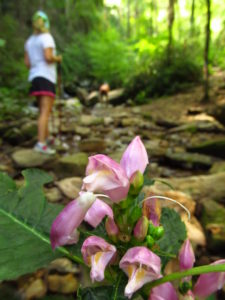
The forest reflects the damp character of a closing gorge—black birch, buckeye, and maple. Wildflowers are abundant in spring, from showy orchis to trillium, while stinging nettle and jewelweed crowd the trail in late summer.
You are now following West Fork Dry Creek, which is large enough to support trout. You may see them finning in still pools. At 0.8 mile, the trail bridges the clear stream. This sturdy iron structure reveals a bird’s eye view of the clear waters below.
At 1.1 miles, cross back over to the right bank. No bridge here, just a series of big boulders lined up to ease the rock hop. The path becomes rooty and rocky. The far-side bluff rises majestically to about 120 feet. The gray monolith is known as Cathedral Rock.
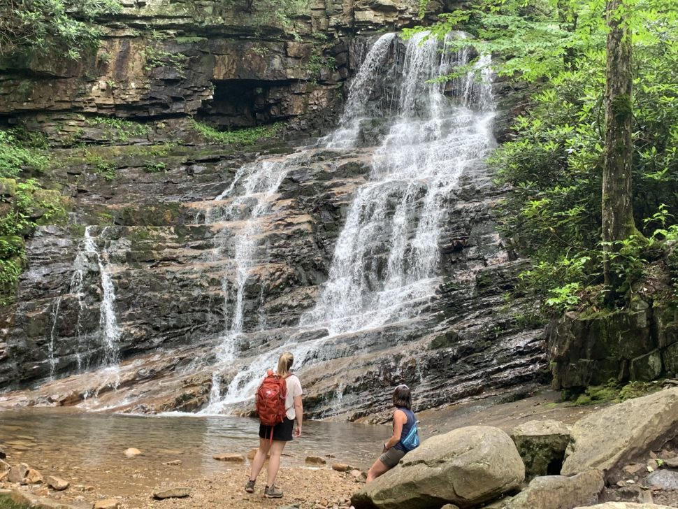
The trail ends at 1.3 miles in an amphitheater of rock and water, where Margarette Falls has carved itself a place in Tennessee lore. Here, the tributary meets the erosion-resistant bedrock and falls 60 feet in ribbons over wide layers of stone. On a hot summer day, the air here is a good 10° cooler than at the trailhead. In winter, the falls can ice over. There are several flat rocks to enjoy the falls alongside a picnic, rest, or perhaps even a jump in the water to cool down.
Guided Trips
For guided day and overnight backpacking trips, we recommend White Blaze Outdoors.
Leave No Trace
Remember to leave our trails with no trace, so adventures can last a lifetime. Find out how you can make a difference with our leaders for litter-free Tennessee efforts.

Johnny Molloy is the author of many outdoor guides including Best Tent Camping: Tennessee, Paddling Tennessee, and Five Star Trails Tri-Cities: East Tennessee and Southwest Virginia.